- AKA: Isneg, Isnag, Mandaya, Ibulus, Imandaya, Imal-lod, Itne'g, Kalina', Apayaw, Iapayaw, Imandaya, Imallod, Idamma’n, Abulog
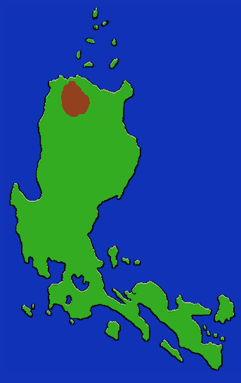
- Location: N. Luzon, Kalinga-Apayao Province.
- Subgroups: Kabugao-Mandaya-Tawit, Karawagan, Talifugu.
- Subsistence: Slash and burn agriculture; intensive wet rice in lover regions. Rice is a prestige crop with yams, taro, corn and sweet potato supplementing the diet.
- Population: 27,627 (1980) - 24,844 in Kalinga-Apayao province. Concentrated in Pudtol, Kabugao, Kalanasan, and Conner municipalities.
The Apayao derive their name from their traditional orientation along the Abalug (Apayao) and Matalag river systems in the northern end of the Cordillera range in Kalinga-Apayao Province. They live in well-built multiple family houses clustered together in small, permanent, kin-based villages. Large kinship groups are led by a mengal who has distinguished himself economically as well as demonstrating other leadership skills. Propitious events are commemorated in a feast called the sayam, in which prestigious males compete at boasting around a ritual stone, while specialized female attendants communicate with the spiritual world.