- AKA: Ilocano
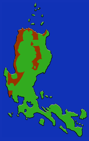
- Location: NW Luzon, especially provinces of Ilocos Norte, Ilocos Sur, La Union, Abra, and Cagayan. Concentrated at mouths of Laoag and Abra Rivers.
- Languages: Ilokano; ten known dialects
- Subgroups: "Northern" and "Southern"
- Subsistence: Lowland rice, fishing; cash crops such as tobacco and garlic.
- Population: 5,915,557 (1990)
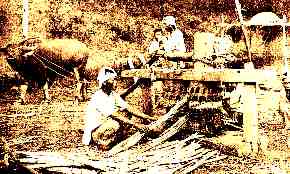
The annual extremes of monsoon and drought of their traditional habitat on the coastal plain of northwestern Luzon seem to have tempered the Ilokano into a very hardy people. They have extended into many other areas of the island, and are currently the third most populous group after the Tagalog and Cebuano. Since there is not enough agricultural land to satisfy the needs of the population, Ilokano depend heavily on trade and the labor market. The textile industry is an important facet of the culture. Since the Ilokano live in the area closest to the Chinese mainland, it is thought by some that at one time there was a heavy genetic and cultural Chinese influence on the area, although little evidence of this survives today. The Tingguan are an offshoot of the Ilokano who moved into the hills and have maintained many of what are thought to be their original traditions.