- AKA: Mangwanga, Mangrangan, Managosan, Magosan, Pagsupan, Divavaonon, Dibabaon, Mansaka.
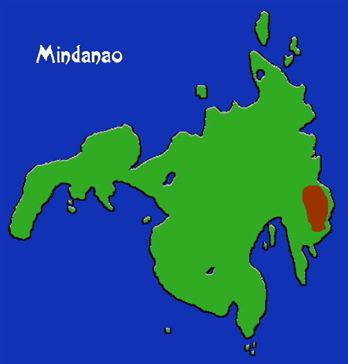
- Location: Mindanao, Davao Oriental province.
- Subgroups: Mansaka, Pagsupan, Mangwanga (Magrangan, Compostela), Managosan (Magosan), Divavaon (Dibabaon, Mixed Manobo-Mandaya), Karaga.
- Subsistence: Wide range of swidden crops, abaca as cash crop.
- Population: 172,506 (1994)
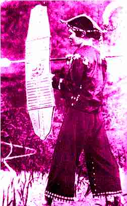
The Mandaya/Mansaka are famous for their distinctive costumes and ornamentation, which involves tie-dyed textiles and embroidery using a sophisticated system of symbols with named motifs. Beadwork and silver craft are also well-developed. Concentrated in the towns of Caraga, Manay, Cateel, Lupon, and Tarragona, the Mandaya live in dispersed settlements in upstream areas practicing slash and burn cultivation. They live mainly on rice, various tubers, and bananas. Houses, which may contain up to three family units, are spatially organized into kinship-based neighborhoods and always placed within eyesight of each other. Families may be nuclear or polygynous. Traditionally, each neighborhood is ruled by a distinctively dressed headman, bagani, who receives advice from a council of elders, angtutukay; in many areas, however, this has been replaced by the barangay.