- AKA: see Subgroups
- Location: Southwestern Sulu archipelago
- Languages: Sama, with 3 major groupings: Western, Eastern (Pangutaran), and Central
- Subgroups: AA Sama, Jama Mapun, Samal, Balangini, Balangingi, Bangingi, Pangutaran, Bajau, Badjau
- Subsistence: Marine, lowland rice, cassava (preferred food), copra.
- Population: 319,809 (1994)
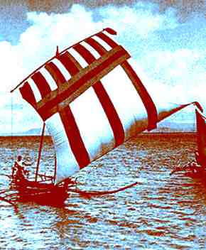
The Sama are a highly diverse and widespread group concentrated in Sulu and Tawi-Tawi, the two southernmost provinces of the Philippines. They divide themselves into two major groups according to lifeways: the Sama Dilaut (often mistakenly called Badjao), with a marine orientation and much of the indigenous culture intact; and the Sama Diliya, who lead an agricultural existence and are much more Islamicized. Both have affinities with groups of northern Borneo. The people identify themselves according to their home island and dialect, which actually results in about 20 subgroups. The culture is basically lowland Southeast Asian. Trade is an important facet of the culture, and in some areas, especially the island of Sibutu, shipbuilding is a major industry. While many actually live on their boats, many others live in houses built on posts over shallow waters with their various boats moored nearby, in areas sheltered from strong weather. The Sama inter their dead inland, in cemeteries with ornate wooden markers which represent the dead riding duyongs or sea cows. Core populations are in Sitangkai (30328), Pangutaran (14382), Siasi (15248), and Tandubas (16706) (NSO 1990).